Festival Guide
Bogue Sound and the Crystal Coast: A Local Reader's Guide
A plain guide to Bogue Sound and the Crystal Coast of North Carolina: the water, the islands, the crossings, and where the dated local record is kept.
The editorial team of Second Street Almanac
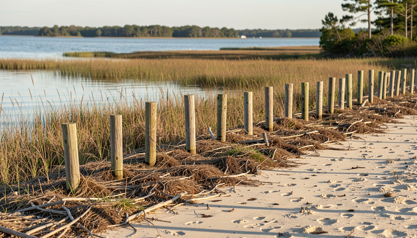
Bogue Sound is the shallow sound that runs behind Bogue Banks, the barrier island holding Atlantic Beach, Pine Knoll Shores, Salter Path and Emerald Isle. The Crystal Coast is the name used for this stretch of Carteret County, North Carolina, where the sound sits on one side of the causeway and the open ocean on the other. A reader who wants the local picture should start with the water itself, because tide, wind and depth decide what a day here looks like.
What the water is doing, and who writes it down
A dated log of Bogue Sound and the country around it is kept from the causeway between Morehead City and Atlantic Beach. Each entry records what the water was doing, what it is read at, and which body publishes the figures behind it. Nothing in that log is sold, booked or announced on behalf of anyone, and no number appears that cannot be traced to the page it came from. That last rule matters more than it sounds. A tide height, a closure date or a crossing time is only useful if a reader can follow it back to the office or agency that issued it.
Where is Bogue Sound, and what makes it different?
Bogue Sound lies between the mainland towns of Morehead City and Beaufort and the barrier island of Bogue Banks. It is wide and shallow, so wind moves water across it quickly and the tide turns with a visible lag from the open ocean. The marsh edge on the mainland side is the first thing to look at: wide water at the turn of the tide, seen across the marsh edge, tells a reader more about the coming hours than any forecast summary.
Two inlets connect the sound to the ocean, Bogue Inlet at the western end near Emerald Isle and Beaufort Inlet at the eastern end. Beaufort Inlet is the deeper and busier of the two, and it is the one that carries traffic in and out of Morehead City. Because the sound is shallow, small boats, paddle craft and ferries all read the same water differently, and a depth that suits one does not suit another.
How do you reach Shackleford Banks and Cape Lookout?
You do not need to own a boat to stand on Shackleford Banks or walk up to the black and white diamonds of Cape Lookout. Passenger boats run from Beaufort and from Harkers Island, and the crossing is short enough to fit inside a morning. What the crossing asks of a visitor is timing rather than distance. The boats work around tide and wind, and a return time is part of the ticket, not an afterthought.
Shackleford Banks is a barrier island with a herd of wild horses on the dune line behind the beach. Cape Lookout holds the lighthouse and the hook of sand that gives the cape its shape. Both sit inside Cape Lookout National Seashore, which is managed by the National Park Service, and both have rules about where a visitor may walk and what may be carried ashore. A passenger boat over the beach, horses on the dune line behind, is the ordinary view on the way in.
What does a family day on Bogue Banks look like?
The island runs east to west between the sound and the open ocean, and a family day here is really two days folded into one. The ocean side gives surf, a long strand and lifeguarded beaches in the developed towns. The sound side gives flat, warm, shallow water, which suits small children and anyone carrying a board to the water below the stand.
Season changes the shape of the day. In spring the water is cool and the wind is steady, so the sound side is the better half. In summer both sides work, and the practical question becomes parking and shade. In autumn the ocean stays warm longer than the air, and the beaches empty out. In winter the island is quiet, and the sound side is where the light is.
Why does Bogue Banks move, and how is the beach put back?
The island you stand on at Atlantic Beach was not always here in the shape you see. Barrier islands move. Storms cut channels through them, currents carry sand along the shore, and the dune line shifts with the wind. New sand over the dune line, with the wind already moving it, is a familiar sight after a nourishment project.
Beach nourishment places sand dredged from offshore or from an inlet onto the beach. It is a repeating practice on Bogue Banks, and it is paid for through a mix of local, state and federal funds. The work is temporary by design. A reader who wants to understand a particular project should look for the permit and the funding record rather than the press release, because the permit states where the sand comes from and how much of it there is.
What does hurricane season mean on the causeway?
A hurricane watch over Carteret County is not a forecast that the storm will arrive, it is a notice that it could, and that the time to decide is now. The road across the marsh with the sound on both shoulders is the only way on and off Bogue Banks for most residents, and that single fact drives the local planning.
A watch means conditions are possible within the stated period. A warning means they are expected. The difference decides whether a household leaves early or waits. Carteret County publishes evacuation zones and routes, and the zones are based on storm surge rather than wind. That is why a sound-side address can be told to leave before an oceanfront one, or the reverse, depending on the track.
Where does the local record come from?
A reader who wants numbers rather than impressions has several places to look. Tide predictions come from the National Oceanic and Atmospheric Administration. Weather warnings come from the National Weather Service office in Newport, North Carolina. Beach closures and nesting rules come from the agencies that manage the seashore and the state beaches. Each of these publishes on its own page, and each page can be cited.
The value of a dated local log is that it points back to those pages instead of replacing them. An entry that says what the water was doing, what it is read at, and which body publishes the figures behind it gives a reader three separate things to check. That is a different offer from a general travel page, and it is the reason a log kept from the causeway is worth reading alongside the official sources rather than instead of them.
How should a visitor use all of this?
Start with the tide, because the tide decides when the sound side is walkable and when the inlet is passable. Then check the wind, because wind moves shallow water. Then check the season, because nesting closures and hurricane watches both run on a calendar rather than on the day's weather. Only after those three should a visitor pick a beach, a boat or a restaurant.
A short list works better than a long one. One ocean beach, one sound-side access, one crossing to an island, and one indoor option for the afternoon thunderstorm that arrives in July and August. Carteret County is small enough that a visitor can cover the ground in a few days without rushing, and the water rewards a slower reading than a checklist allows.